Problem and Objective
I’ve been hired by Black Water National Wildlife Refuge as a GIS Analyst. The refuge is in the process of implementing upgrades to the Refuge and are developing a management plan. They have requested that I complete a supervised image classification to produce some land cover data to review.
Analysis Procedure
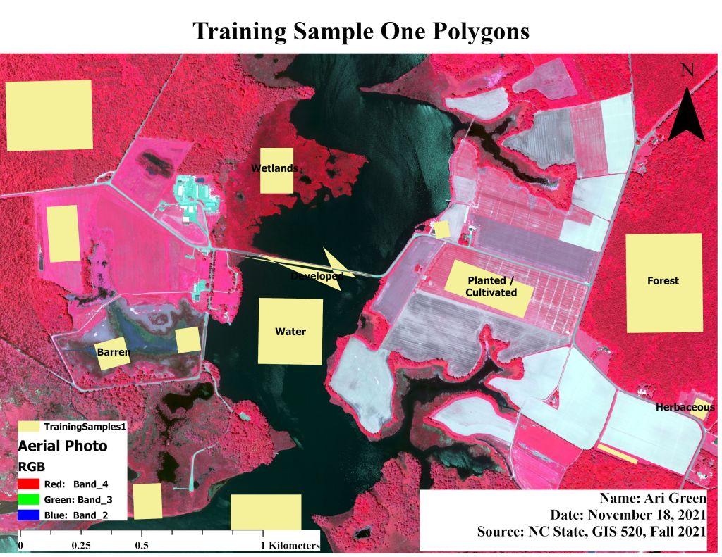
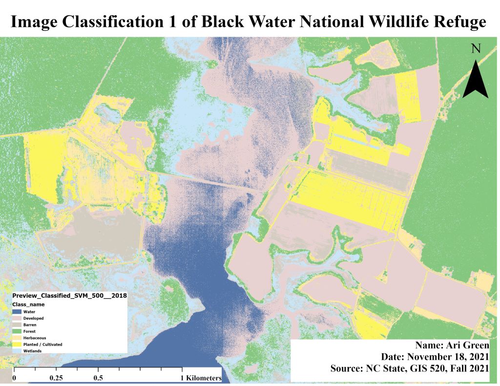
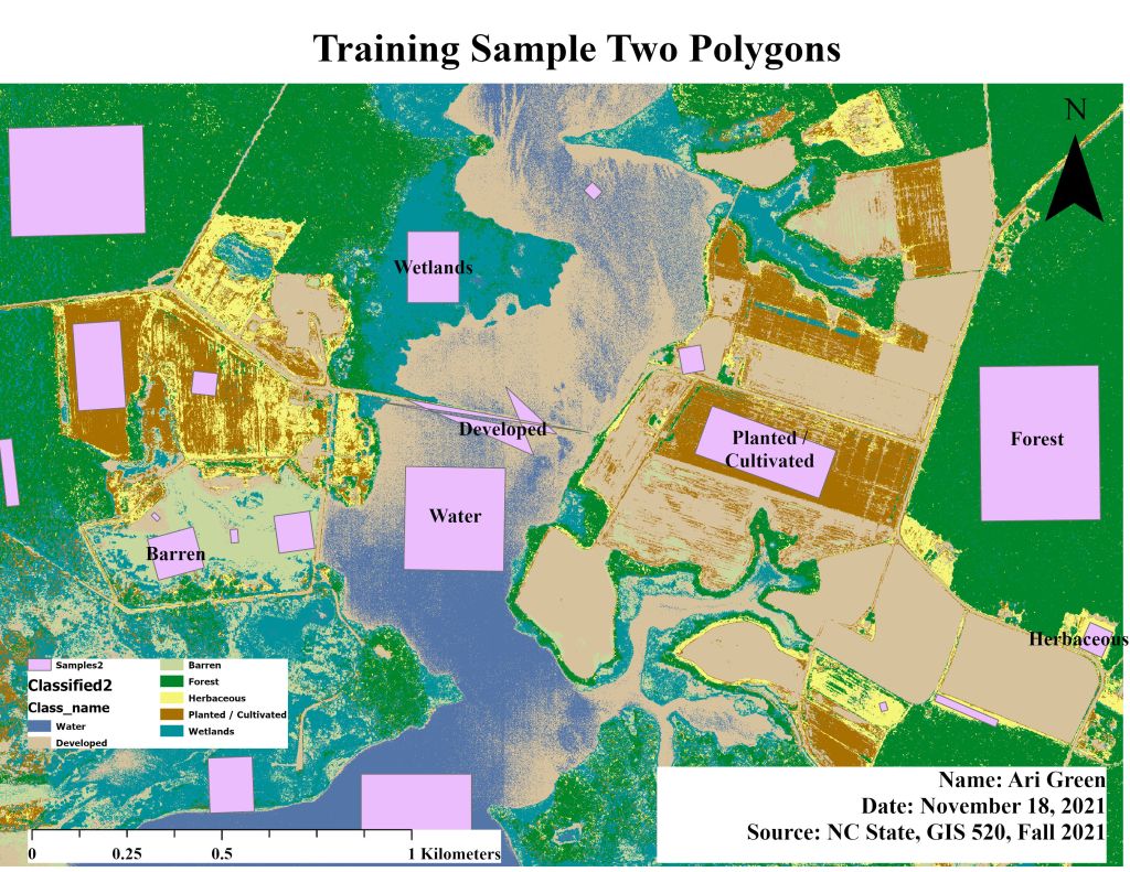
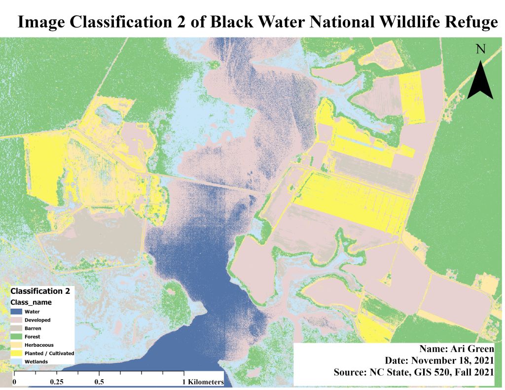
To complete a supervised image classification, I used ArcPro and a series of classification tools to complete the analysis. The primary input data used for this assignment came in the form of an aerial photo (.tif file). Aerial photos can be analyzed by using analysis tools to identify or extract information classes such as land cover categories. First, I changed the symbology for m_3807640cr.tif, making band 4 = Red, band_3 = Green, and band_2 = Blue. Then I used the Training Sample Manager tool to collect 2 samples of barren, cultivated, developed, forest, herbaceous, water, and wetlands from the .tif file. Within the Training Sample Manager tool, I merged like samples or used the collapse function to combine the multiple samples (i.e.: water + water or forest + forest). Once I merged the samples, I exported the training samples as a shapefile. Next, I used the “classify” tool on my training sample shapefile and the output named. I used the “Export Raster” tool on the classified training sample shapefile. Next, I performed the Builder Raster Attribute Table tool to create an attribute table on the ClassifiedRaster. Then I used the “Add Field” tool to create a field to determine the area of each class. To calculate the area, I used the formula “1 x !count!” within the Calculate Field tool. I repeated this process for the second set of samples by adding two samples within the Training Sample Manager. Then I used the Classification Wizard to perform a Supervised Classification for each set of training samples.
Results
Application and Reflection
In completing assignment 10, I understand why image classification is necessary. After completing this assignment image classification is useful when companies or local want to develop new buildings in an area. The results of an image classification can be used to create thematic maps, analyze cover, or examine spatial relationships. For example, the City of Raleigh is in talks of building a soccer stadium. Not only does the city have to rezone the area, but they will also need GIS analysts to conduct a land cover analysis of the land/site in question. If the aerial image of the site/land in question has a river, a city, and some farmland, assigning a range of pixel values to each land type and classifying the aerial image would create a series of maps that display the change in landcover over time.
Problem Description: The City of Raleigh has proposed building a soccer stadium in the city but by law, they have to notify residents of the proposed building plans with land cover analysis of the proposed site.
Data Needed: City of Raleigh Boundary, 2020 Census demographic data, list of land owned by the city, Raleigh roads, Freeways
Analysis Procedures: GIS analysts must use a current aerial photo of the proposed stadium location, and collect training samples from the land to determine if the land is feasible for building a stadium on. Analysts must also consider past businesses that were built on or near the site.
