Problem and Objective
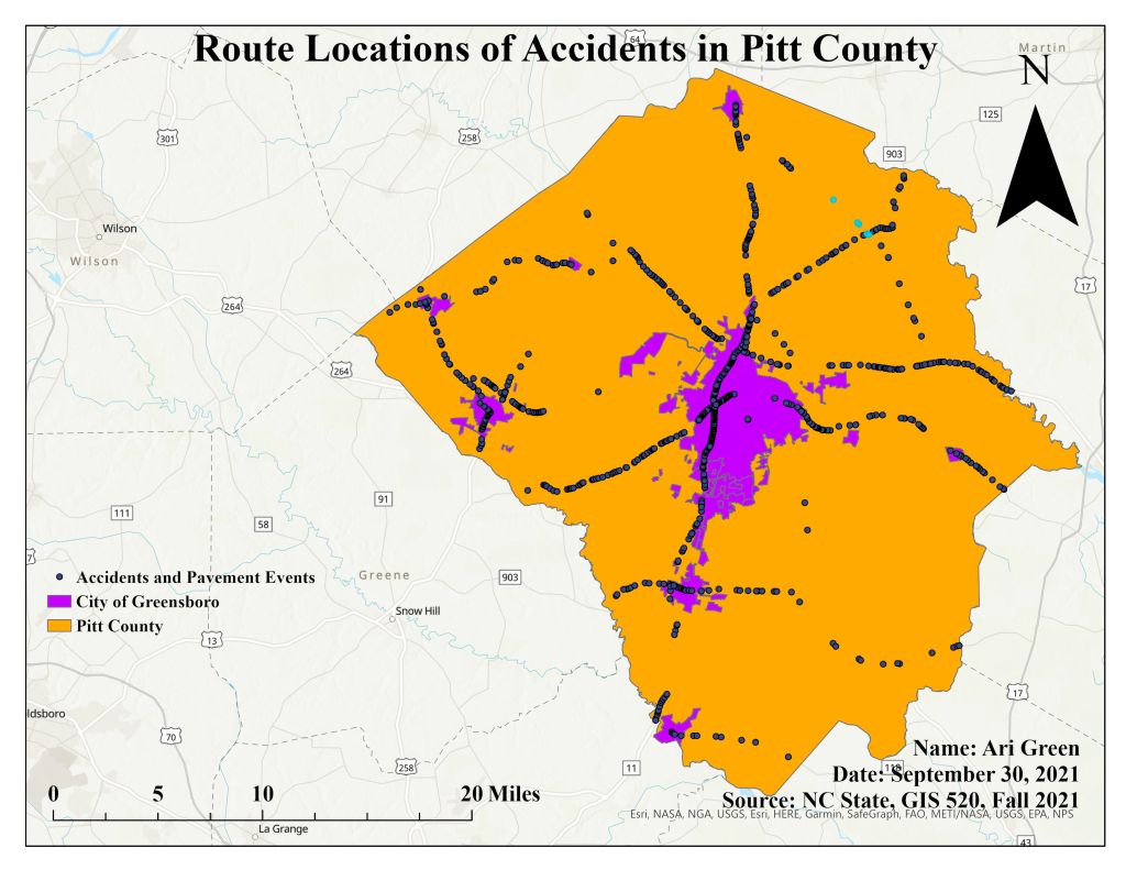
The city of Greenville in North Carolina has requested that the GIS department evaluate and give a report on accidents that happen on roads in Pitt County to determine if the roads are the primary cause for accidents. Since the usual ArcPro software has not been updated to perform linear referencing analyses, they have asked that a customized Linear Reference tool bar be developed to assist in the analysis. So the primary objective of this assignment is to establish the correlation between accidents and the roads in Pitt County using linear referencing.
Analysis Procedure
To analyze the number of accidents and the types of roads in Pitt County, I used ArcGIS Pro and customized a Linear Referencing ribbon that would allow me to use tools such as Make Route Event Layer, Identify Route Locations, and Overlay Route Events. The primary input data for this assignment came in the form of a geodatabase (.gdb), which included a city boundary, county boundary, and two standalone tables with accidents data and pavements data. Geographic data can be stored using the method of linear referencing. First, I chose a proper color scheme to display my city, county, and some_routes layer. Then I used the select by attribute tool and created the expression route1 = 30000030. On this highlighted route, I used to the Identify Route Location tool within the Linear Referencing Ribbon to determine that minimum and maximum values of measures on the route. This tool also helped calculate how many road segments in the route. This assignment called for the use of the Select by Attribute tool multiple times to determine the number of accidents in Route 30000030, the number of segments that have a rating greater than and less than 75, and to calculate total miles of certain segments. The Make Route Event Layer tool was also utilized to be able to display accidents along a route and display roads. And lastly, the Overlay Route Event tool was used to intersect the accidents table and the pavements2 table and display the geospatial data.
Results
Application and Reflection
Analyzing geographic data through linear referencing methods is an important analysis tool when working with ArcGIS Pro because it can be used to apply upgrades to cities in terms of construction and engineering. The ability to store large geospatial data in one place and make that data available in the form of event layers is useful for different occasions. These occasions include building highways or highway connection through states, evaluating rivers and their connections to larger bodies of water, and streets that turn into highways or freeways. Specifically, linear referencing methods is important when new neighborhoods are developed, and new streets are built when new homes are constructed. Linear referencing methods allow cities, software such as Google Maps and GPS Systems to update with new street names that allow people to locate where they are going.
Problem Description: The City of Raleigh developed a new community with the creation of new with 25 new homes. GIS analysts need to update the nearby linear features with new gas pipelines, streets, and power lines of the new community.
Data Needed: City of Raleigh Boundary, Wake County Boundary, Wake County Roads
Analysis Procedure: To add the updates, a custom Linear Referencing Ribbon needs to be created in ArcPro. Then use the Make Route Event tool to create/add the newly developed streets.
