Problem and Objective
Several black bears continue to resurface at the Great Smoky Mountains National Park after biologists capture and relocate them. The Black bears tend to resurface in areas that are active with park visitors. The biologists at Great Smoky Mountains National Park have hired me as a GIS Analyst to complete a suitability analysis to help identify areas with different levels of suitability for bear habitat.
Analysis Procedure
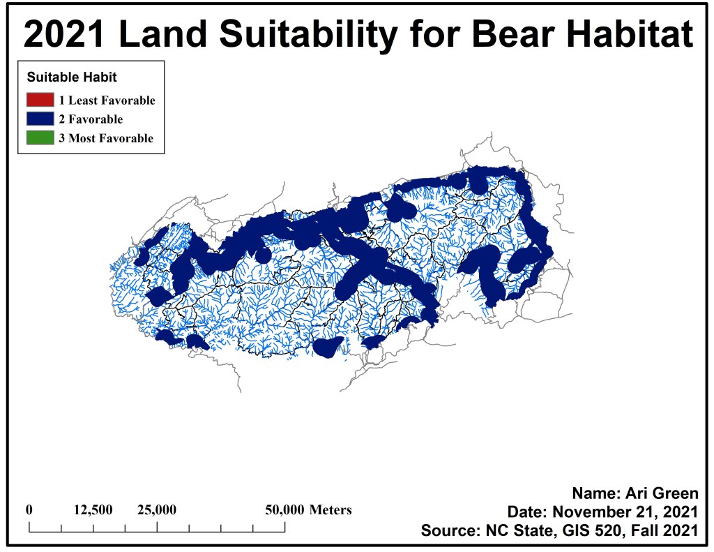
To identify potential suitability areas, I used ArcMap and completed a suitability analysis with a weighted overlay function and model builder. The primary input data used for this assignment came in the form of vector shapefiles for roads, streams, trails, and vegetation classes. And a raster grid file to display elevation. Geospatial data can be analyzed by using analysis tools to identify where something should be – or site selection. First, I used the Slope spatial analyst tool on elevation raster grid file to determine the overall slope. Then I used the “Feature to Raster” tool to convert the vegetation shapefile to raster image, I used the “classes” field for the conversion. For the next step, I utilized the “Euclidean distance” tool for the roads, streams, trails, and vegetation layers. When running this tool 4 times, I made the cell size 30, and the maximum distance 1609.344 (1 mile). Then I used the “reclassify” tool five times for each respective layer. When reclassifying the slope raster image, the new values became 0-30 =1, 30-60 =2, and 60-90=3. For the vegetation raster, grape thickets =1, cove hardwood-mixed mesic-northern hardwood=2, and all other classes were labeled 3. For layers roads and trails 0-804.672=3, 804.672-1609.344=2, and 1609.344=1. Finally, for the layer streams 0-804.672=1, 804.672-1609.344=2, and 1609.344=3. Lastly, I utilized the “weighted overlay” tool. I set the evaluation scale to 1-3, had each layer weighted equally (all 5 at 20%).
Results
Application and Reflection
In completing assignment 9, I understand why site selection/suitability analysis including a weighted overlay are necessary and its use. The Esri course was very clear on why institutions and companies might use suitability analysis. After completing the Esri course and completing assignment 9, site selection/suitability analysis can be used by the U.S. Military when determining potential and the best place to build new military bases. Site selection can also be used by local governments and counties when identifying where to build new trauma hospitals. For example, the City of Sacramento (California), expressed concerns over not having enough trauma hospitals to treat patients. While updating their 2030 Master Plan for the city, I imagine they have included forthcoming development projects. To do this, they would need their GIS analysts to conduct multiple site selection and suitability analysis to identify sites where trauma hospitals could be built. With criteria like population density, access to roads/freeways, and fire stations.
Problem Description: The City of Sacramento asked its gis analysts to conduct a suitability analysis to determine the best place to build new trauma hospitals to go along with 2030 Master Plan. Analysts much consider population density, access to roads and freeways, as well as fire stations, and land cover and weigh each criteria.
Data Needed: 2020 Population density by census tract (for Sacramento), City of Sacramento Fire Station locations, Freeways, Roads
Analysis Procedures: GIS Analysts must consider population density, proximity to fire stations, access to freeways, and land mass availability including access to power and gas lines.
